
DEM data for Portugal
EN/PT
The links below contain digital elevation models for the area of mainland Portugal, derived from satellite data: SRTM, ASTER, ALOS-Prism and TerraSAR-X. These data are free but any use should refer their origin (NASA, JAXA, DLR) and this web page in what concerns the data preparation for the area of Continental Portugal. See below details about the original datasets.
One degree tiles for the area from (10W,36N) to (6W,43N) were merged in a continuous raster. Small groups of void pixels were filled by interpolation using GDAL command Gdal_fillnodata. The raster was projected into the Portuguese national map projection PT-TM06 of datum ETRS89 (EPSG:3763) using GDAL command Gdalwarp, with a pixel size of 25 meters (1" lat-long pixel at 39d40'N has 30.84 m by 23.84 m). Pixel values were obtained by bilinear resampling. In the case of the TerraSAR-X, with a resolution of 3" in geographic coordinates, the projeted pixel size was chosen as 80 m. All heights are above sea level. Coordinate limits of the projected rasters were chosen as integer numbers in kilometers: (-120, 302) to (164, 278). At this resolution ETRS89 and WGS84 are considered coincident.
All datasets are in GeoTiff format, 16 bit integers, deflate compression, with tiles and internal overviews, starting at level 4.Download
| | SRTM-DEM EPSG:4326, GSD=1" |
| | SRTM-DEM EPSG:3763, GSD=25m |
| | ASTER-GDEM EPSG:4326, GSD=1" |
| | ASTER-GDEM EPSG:3763, GSD=25m |
| | ALOS-AW3D30 EPSG:4326, GSD=1" |
| | ALOS-AW3D30 EPSG:3763, GSD=25m |
| | TanDEM-X-90 EPSG:4326, GSD=3" |
| | TanDEM-X-90 EPSG:3763, GSD=80m |
| | QGIS project file with DEMs loaded from the GIS server. |
Note: If your browser prevents download for security reasons click with the right button and choose "save link as".
Comparison of DEMs
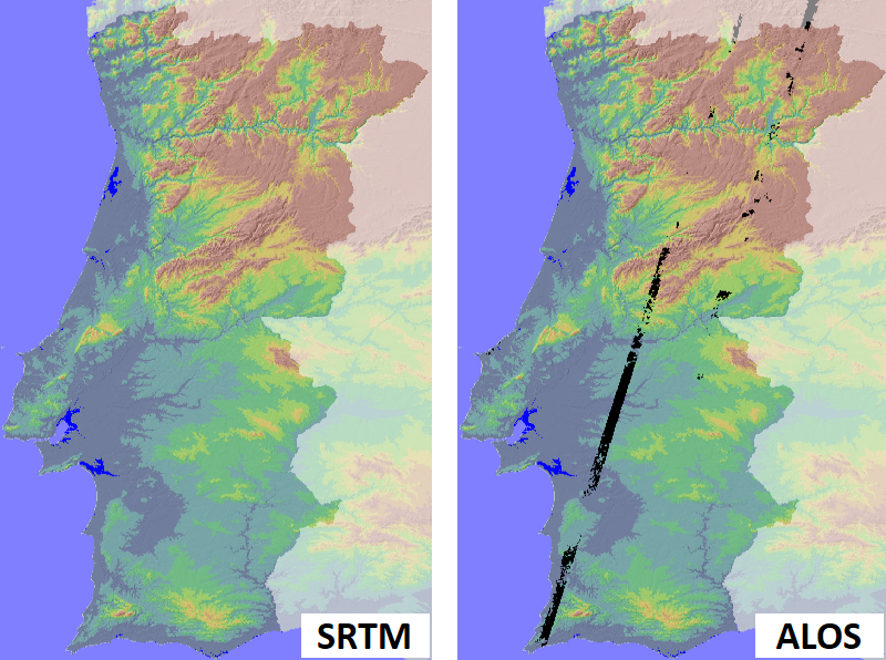
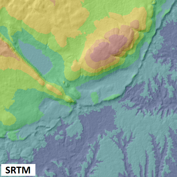
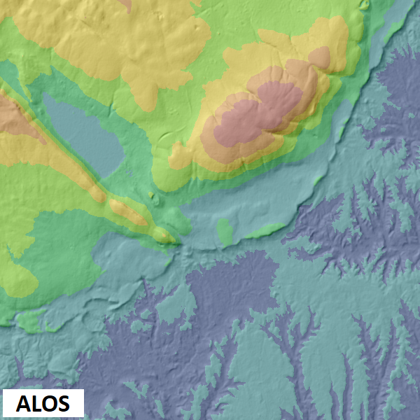
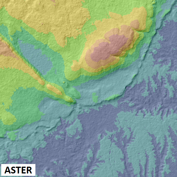
The figures below show the 4 DEMs for an area of 15 km by 15 km (Serra de Aire). The best quality DEM is the ALOS AW3D. Its main limitation is the relatively large number of void pixels in two strips (figure on top of the page).

Original datasets
SRTM-DEM was obtained by the Shuttle Radar Topography Mission by SAR Interferometry, in an approximate resolution of 30 m, between latitudes 60S and 60N. Data are available in 14297 granules of 1 by 1 degrees, from NASA Earth Data.
ASTER-GDEM was obtained by photogrammetric methods from the Japanese ASTER-VNIR sensor (infra-red nadir and backwards sensors with 15 m GSD). Data are available for most of the planet in 22912 granules of 1 by 1 degrees from the NASA Earth Data and from Japan Space Systems.
ALOS World 3D DEM was obtained by photogrametric methods from sensor PRISM onboard the Japanese ALOS satellite. PRISM is a triple linear sensor (forward, nadir and backward) which generates panchromatic images with a GSD of 2.5 m. Data was processed in order to obtain DEMs in a spatial resolution of 1 arc-second. Data are available from the Japanese Space Agency - JAXA.
The TerraSAR-X DEM was obtained by the Tandem TerraSAR-X mission, using SAR interferometry. Terrain elevation is obtained in a resolution of 10 meters, but is made available in 3 arc-seconds grid spacing. Data can be obtained from the DLR Geoservice.
Data and web page prepared by: José Alberto Gonçalves (jagoncal at fc.up.pt), André Pinhal (apinhal at fc.up.pt) and Ana Bio (anabio at ciimar.up.pt)