
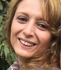
Ana Cláudia Teodoro (Lab coordinator)
Ana Cláudia Teodoro was born in Porto, Portugal, in 1974. She received the BS., MSc., PhD and Habilitation degrees in Surveying Engineering from Faculty of Science, University of Porto (FCUP), in 1998, 2001, 2007 and 2016 respectively. During 1998-2007 she was a teaching assistant in Applied Mathematics Dep., in FCUP, asince 2024 she is Full Professor at FCUP (between 2007 and 2010 in Applied Mathematics Dep., and since 2010 in Geosciences, Environment and Land Planning Dep.). Between 1999 and 2015 she was a researcher at Geo-Space Sciences Research Centre, FCUP. Since 2015 she is a senior researcher at the Earth Sciences Institute, University of Porto, Portugal. Her research interests include remote sensing (environmental applications), GIS, image processing, coastal zones, and geological applications. She has published more than 40 journal articles in peer review journals (ISI WoS) and eight book chapters. She is Editor of two journals and Guest Editor in several Special Issues of different international peer-review journals. Her publications reflect her research interests in remote sensing and GIS area. She is also a member of the Scientific Committee of IEEE/GRSS International Geoscience and Remote Sensing Symposium and SPIE Remote Sensing. She is a reviewer for more than 40 journals, having reviewed more than 200 manuscripts in total. She has also experience in project evaluation (EU Projects). Now, she is vice-director of the Dep. Geoscience Environment and Land Planning; Director of first degree in Geospatial Engineering (FCUP) and coordinator of North Region of Engineers Association.
ORCID:https://orcid.org/0000-0002-8043-6431Senior Researchers
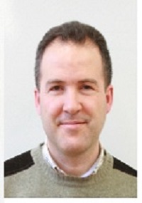
Alexandre Lima
Prof. Alexandre Lima holds a PhD degree (2000) in geology at the University of Porto, Portugal, in co-tutelle with INPL, Nancy, France. Since 2000 is Associate Professor at University of Porto. He has experience, working in the fields of exploration, geochemistry and mineralogy of rare-metal and industrial mineral deposits and more than 15 years’ post-doctoral research experience in the exploration, nature and origin of pegmatites and related mineralisation. His research has led to the publication of more than 10 papers in peer reviewed journals in earth sciences. Highlights include publications on the exploration of Li pegmatites, significance of the phosphates on pegmatites, pegmatites from the main Li pegmatite field in Portugal, and significance of micas in pegmatites. Participated on the most important paper about Li pegmatites in Iberia. He is developing work on GIS pegmatite exploration and Remote sense exploration. Is dedicating also his knowledge on Metallogeny to support mining archaeology studies in Portugal. Since 2018 is the FCUP project leader of LIGHTS “Lightweight Integrated Ground and Airborne Hyperspectral Topological Solution”, and since 2019 on project AUREOLE “tArgeting eU cRitical mEtals (Sb, W) and predictability of Sb-As-Hg envirOnmentaL issuEs”. In May 2007 organized together with Pays Basque University, the 3th International Symposium on Granitic Pegmatites PEG2007 in Porto, Portugal, gathering c. 100 geoscientists, mining and processing engineers, mineral and gemstone dealers from all over the world working on pegmatite deposits. Later in 2009 was the co-Chair of the 4th International Symposium on Granitic Pegmatites (PEG 2009) in Brazil.
ORCID:http://orcid.org/0000-0002-6598-5934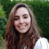
Joana Cardoso Fernandes
Joana Cardoso-Fernandes completed her PhD in Geosciences in 2021/10/29 by Universidade do Porto Faculdade de Ciências and Universidade de Aveiro (European doctor title). Joana works as a PhD researcher (contract) at Universidade do Porto Faculdade de Ciências. Published 20 articles in journals. Organized 7 events. She co-supervised or is co-supervising 2 PhD thesis, 4 MSc dissertations, 7 works of course completion of BSc and 4 Scientific initiation grants. Has received 8 awards and/or honors. In her curriculum the most frequent terms in the context of scientific output are: Reflectance spectroscopy; Geological exploration; Remote sensing; Pegmatite; Lithium; Spectral Signature; Database; L. She also has experience in Python programming and machine learning applications; Petrography; Geochemistry applied to mineral exploration (including stream sediment analysis); and field work related to pegmatite exploration.
ORCID:https://orcid.org/0000-0001-8265-3897
Lia Duarte
PhD, Master and Engineering degree in Geomatics from the Faculty of Science, University of Porto (FCUP), respectively in 2017, 2011 and 2009. From October 2011 until August 2017 she was an invited assistant at the Department of Geosciences, Environment and Land Planning at FCUP, where teaches several courses from the Geomatics area, Topography, Applied Topography, Cartography, Geographic Information Systems (GIS) and Geographic Information Fundamentals. From September 2017 until August 2019, she was an invited Auxiliar Professor at the same department. And since November 2019 she is an Auxiliar Professor. She belonged to the Research Centre of Geo-Spatial Sciences until 2014 and since 2015 she is a researcher at the Institute of Earth Sciences (ICT). She works with GIS open source applications.
ORCID:https://orcid.org/0000-0002-7537-6606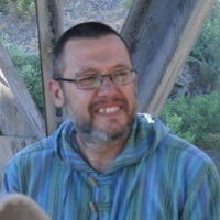
Neftallí Sillero
Neftalí Sillero is a spatial biologist interested in the analysis and identification of biological spatial patterns, from species distributions to populations and individuals, using GIS, Remote Sensing, Ecological Niche Modelling, and Spatial Statistics. His main research lines are related to ecological niche models, road ecology, distribution atlases, and home ranges. Since 2007, Neftalí Sillero is the chairman of the Mapping Committee of the Societas Europaea Herpetologica, where I coordinate the Atlas of Europe. He is currently the research coordinator of the FCUP team in the conservation LIFE project LINES (Linear Infrastructure Networks with Ecological Solutions).
ORCID:https://orcid.org/0000-0002-3490-3780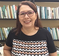
Norma Beltrao
Post-doctorate in Remote Sensing at the Faculty of Sciences of the University of Porto (FCUP), Portugal (2017-2019), PhD in Agricultural Economics at Justus-Liebig-Universität Giessen in Germany (2008), certified by the Federal University of Rio Grande do Sul (UFRGS) as a Doctorate in Rural Development, Master's degree in Production Engineering from the Federal University of Santa Catarina (1996), and a degree in Civil Engineering from the Federal University of Pará (1992). She has been an effective professor at the State University of Pará (UEPA) since 1998, where she has worked in parallel with other management positions, including coordinating undergraduate and postgraduate courses, UEPA Extension Director, Director of Environmental Planning at SEMA ( Secretary of State for the Environment - 2011), Board of the Planetarium of Pará, Head of the Department of Applied Social Sciences, among other functions. He is currently an Associate Professor IV of the State University of Pará, acting in the Department of Applied Social Sciences and Permanent Professor of the Postgraduate Program in Environmental Sciences (Master's degree). In the research area, leader of the research group NUPAD - Center for Research Applied to Regional Development and research in the areas of Regional Development, Environmental Policy and Management, Environmental Economics, Environmental Valuation, Ecosystem Services and the Use of Geoprocessing Methods and Remote Sensing in identification of environmental devices in the Amazon territory using the following tools: QGIS, SNAP and Google Earth Engine.
ORCID:https://orcid.org/0000-0003-1991-2977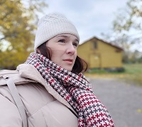
Patrícia Santos
Patrícia Santos was born in Porto in 1982. Holds a degree in Geology in 2005 from Faculty of Sciences in Porto University and a PhD in Geosciences from Porto and Aveiro Universities granted in 2011. Has near a decade of technical experience in the areas of geological exploration, environment and land planning. Currently is a researcher in ICT- Instituto das Ciências da Terra (Institute of the Earth Sciences), has been developing works in the themes of environmental sciences and natural resources in the scope of multiple projects with national and international projection, as CoalMine, SHS and S34I, where she had a chance to develop her GIS and spatial analysis skills.
ORCID:https://orcid.org/0000-0002-6114-1427Junior Researchers
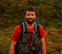
Antonio Azzalini
Antonio Soares Azzalini holds a bachelor's degree in Mining Engineering from Universidade Federal do Rio Grande do Sul-Brasil and a master's degree in Geomaterials and Geological Resources from Universidade de Aveiro/Universidade do Porto-Portugal. During his degree at the UFRGS he worked at the Rock Mechanics Laboratory (Laboratório de Pesquisa Mineral - LPM) and at the Mineral Processing Laboratory (Laboratório de Tecnologia Mineral e Ambiental - LTM). After graduation, he worked in the mining and construction industries for four years, before starting his master's degree in Portugal in 2019. He has worked in mineral exploration and geotechnical projects in Norway and Portugal, and in research projects in Evora University and Porto University, and is part of the 2022 RS and GIS FCUP Lab team since 2022. His research interests include drone-borne data acquisition for mineral exploration using LiDAR and optical sensors. He's also interested in remote sensing applied to the mineral industry, including the use of machine learning and spectral unmixing algorithms to optimize the detection of target zones.
ORCID:https://orcid.org/0000-0003-1058-5463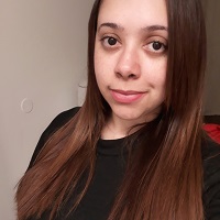
Bárbara Biju
Currently a PhD candidate in Surveying Engineering at Faculty of Sciences of the University of Porto. Received her BS. in Environmental Engineering from Pontifical Catholic University of Paraná (2012), Master’s degree in Civil Engineering - Sanitation and Water Resources, issued by the Federal Technological University of Paraná (2015) - Graduate Program in Civil Engineering (PPGEC). Was a CAPES Scholarship holder, with exclusive dedication to conduct a research in solid waste management, using GIS in conjunction with MCDA as supporting tools. Resulting in the development of a model to assist the decision-making process related to the different stages of solid waste management. In this case, to indicate possible suitable areas for the implementation of inert landfills. Also, she has experience in of solid and C&D waste management, in obtaining, modeling, and processing useful and valuable data for environmental diagnosis. Knowledge in sanitation, air quality, environmental health, assessment, planning and management. Skills in decision-making tools, spatial analysis, GIS tools, ecosystem services, circular economy. In Brazil, worked was a teacher in environmental technician course, at The Federal Institute of Education, Science and Technology of Paraná (IFPR), and was an autonomous consultant as environmental engineer.
ORCID:https://orcid.org/0000-0001-7721-008X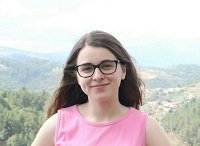
Beatriz Araújo
Beatriz Araújo earned her Bachelor’s Degree in Geology from the Faculty of Sciences of the University of Porto, in 2022, and is currently enrolled in the Master’s Degree in Geology, at the same institution. During her academic journey, she actively participated in diverse activities in the fields of geological mapping, coal ash recycling, and promoting science education in schools.
ORCID:https://orcid.org/0000-0002-5734-6155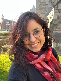
Cátia Rodrigues
Cátia Rodrigues de Almeida holds a Master's degree in Remote Sensing from the Faculty of Sciences of the University of Porto - FCUP (Portugal) (2021), studied Environmental and Sanitary Engineering at Senac (São Paulo/Brazil - 2017), a post-graduate degree in Management in Environment, Safety, Occupational Health and Social Responsibility at Senac (São Paulo/Brazil - 2012) and the Technology course in Environmental and Industrial Management at Faculdade Anhanguera (São Paulo/Brazil - 2008). During her engineering degree, she received a scholarship from the Formula Santander program and studied for 6 months at the Faculty of Engineering, University of Porto (Portugal). In addition to classes, Cátia volunteered as a researcher in projects aimed at obtaining non-food oilseeds for the production of biofuel (biodiesel). Currently, she is a PhD student in Geographic Engineering at FCUP, with a scholarship awarded by the Portuguese Space Agency (Portugal Space) and financed by the Foundation for Science and Technology (FCT). During her academic career, she produced and organized several activities (conferences, forums, congresses and scientific publications). Professionally, she worked at BRF Environmental Services, assisting in the organization of sanitation projects and coordinated Senac's Internal Eco-Efficiency Committee, supporting the organization of the Environment Week, monitoring internal and external selective collection, the compensation of greenhouse gases (CO2) in external events (Carbon Free Label), among other activities.
ORCID:https://orcid.org/0000-0003-4455-9407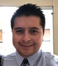
César Ivan Alvarez Mendoza
GIS, Remote Sensing and environment lecturer with more than 9 years in the field of geomatics in Oil & Gas. High experience more than 6 years in the academic field with research projects about drones, environment, Remote Sensing and Web & Programming GIS. I have in my account more than 10 publications about GIS & Remote Sensing. Moreover, I have the capacity to acquire some abilities quickly.
ORCID:https://orcid.org/0000-0001-5629-0893
Douglas Santos
Currently, a doctorate student in Geosciences at the University of Porto, Douglas Santos has a Bachelor's degree in Environmental Engineering from the Universidade Cidade de São Paulo and a Master's in Geographic Information Systems and Spatial Planning from the University of Porto. With experience in processing satellite images to detect areas with potential for geological proposals (identification of LCT pegmatites, NYF pegmatites, and lithium). Worked as a trainee at the São Paulo City Hall and as a scientific researcher fellow at the Faculty of Sciences of the University of Porto on the Greenpeg project. During his professional career has obtained diverse experience in the area of remote sensing such as acquiring new skills regarding the processing of multispectral and hyperspectral images, python language applied to remote sensing, machine learning algorithms for the identification of target minerals, reflectance spectroscopy, methods based in spectral unmixing, among other activities.
ORCID:https://orcid.org/0000-0003-1529-1448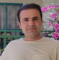
Iraj Rahimi
Presently, he is a PhD candidate in Surveying Engineering at Faculty of Sciences, the University of Porto. He completed his BSc in Geomatic (Surveying) Engineering from the University of Tehran, Tehran, Iran (2009), and his MSc degree in Remote Sensing (RS) from the Kerman Graduate University of Advanced Technology (KGUT), kerman, Iran (2012). Since 2013, he has been a lecturer at Darbandikhan Technical Institute, Polytechnic Univeraity of Sulaimani, Kurdistan Region, Iraq. During his MSc degree and later, he concentrated on local matter in Kurdistan, including Zagros forest fires, Mariwan, Kurdistan Province, Iran, using satellite data. Besides, he cooperated in other researches like, and "Drought monitoring", "Mapping Forest-Fire potentiality, in Kurdistan Region (KR), Iraq", " Mapping distribution of Gypsum and Lime Using RS/GIS ", as well as, Tourism and Urban sprawl in KR, Iraq.
ORCID:https://orcid.org/0009-0002-7411-8637
Juliana Sales dos Santos
Environmental Engineer from CEUMA University (Maranhão/Brazil – 2018), being licensed by the Regional Council of Engineering and Agronomy of Maranhão in Brazil, as well as, by the Order of Engineers of the South of Portugal, with specialization in Geoprocessing and Environmental Analysis by the Federal University of Pará – UFPA (Pará/Brazil – 2022). Master in Geography, with emphasis in Physical Geography, from the Federal University of Maranhão – UFMA (Maranhão/Brazil – 2022), where he worked in the line of research Environment and Spatial Analysis, through the Monitoring of Mangrove Forests in the surroundings of the Lençóis National Park Maranhenses in Brazil. In addition, he was an accountability analyst at the Foundation for Scientific and Technological Research and Development of the State of Maranhão - FAPEMA, where he worked for three years in monitoring and financial auditing of scientific research projects. She is currently a doctoral student in the Graduate Program in Environmental Sciences and Technology at the Faculty of Sciences of the University of Porto in Portugal - FCUP, working on the Assessment of Vulnerabilities to Coastal Erosion and Climate Change in the Port Complex of Itaqui in Brazil. Collaborator of the Laboratory of Studies and Climatic Modeling - LACLIMA, of the Department of Limnology and Oceanography (DEOLI/UFMA) and is part of the Group of Applied Informatics and Geoprocessing - GIAGEO, of the Federal Institute of Maranhão (IFMA), acting in the management of projects of research and development of methodologies for environmental studies using data from climate reanalysis and satellite images, respectively. He has been part of the research group Geotechnologies in the Study of Ecosystems of Maranhão (CNPq) since 2014. He has experience in research in the area of Geographic Information Systems (GIS), Cartography, Remote Sensing and Modeling of Ocean-Atmosphere Interaction, with an interest in multitemporal studies.
ORCID:https://orcid.org/0000-0002-3814-294X
Mariana Oliveira
Mariana Oliveira was born in Porto, Portugal, in 1995. She successfully graduated in the Environmental Sciences and Technology degree in 2016 by the Faculty of Science, University of Porto, where she also took her Master's Degree in Geographic Engineering in 2018. In 2016, she completed an internship with CINTESIS (Center for Health Technology and Services Research), from which resulted her first publication on the relation between the environment and pre-term birth. Later, in 2017/2018, she cooperated again with CINTESIS to write her thesis on the acquisition and analysis of environmental variables and its relation to human health. She is currently doing a PhD in Health Data Science by the Faculty of Medicine, University of Porto.
ORCID:https://orcid.org/0000-0001-7313-9749
Morgana Carvalho
Currently enroled in a Master's degree in Geology at the Faculty of Sciences, University of Porto. Participated as Research Fellow in the AUREOLE project, at University of Porto. Completed a bachelor’s degree in Geology in 2020, at University of Vale do Rio dos Sinos (UNISINOS), Brazil. Worked as research assistant in the Continentais project, a Petrobras project conducted at the UNISINOS university. Experimented, during the academic percurse, different fields of geosciences, such as paleontology, organic petrology, volcanology, numerical modelling and more recently mineral prospectivity.
ORCID:https://orcid.org/0000-0001-9920-0886
Rachida Senouci
Ph.D student in Marine Science and Coastal Environment, Department of Marine Science & Aquaculture, Faculty of Nature Science & Life. University of Mostaganem, Algeria.
ORCID:https://orcid.org/0000-0002-5926-3070
Ubaldo Gemusse
PhD in Geosciences since (21/12/2021) from the University of Porto, Faculty of Sciences, in Portugal, with the thesis entitled, Geological Prospecting of Pegmatites in Alto Ligonha (Zambézia, Mozambique), based on Remote Sensing and Geographic Information System, and is Professor University student since 2011, 9 years at the Pedagogical University, Beira Delegation, and since 2019 at Licungo University, Faculty of Science and Technology, where he is Head of the Geology Department and Coordinator of the Occupational Health and Safety course. He has already taught in the Doctoral Program in Geography at the Pedagogical University, in the subject of Geographic Information Systems. And in the master’s degree in water engineering at Zambezi University, Faculty of Sciences, in the subject of Geography Information Systems, and in the master’s degree in environmental management at Licungo University, in the subject of Geographic Information Systems. He was previously coordinator of the Geological and Mining Engineering course at the Piaget University of Mozambique, where he taught the subjects of Remote Sensing, Mineralogy, Geotechnics, Tectonics. Research in the areas of geology, environment, remote sensing, and GIS. He has already participated in the master’s committee at the University of Porto and PhD, as the main opponent at the State University of Campinas (Brazil) and the Federal University of Recôncavo da Bahia (UFRB). He currently supervises master's and undergraduate studies between Universities (Pedagogica de Maputo, Zambeze and Licungo). He is a geologist and mining, environmental and auditor consultant, accredited by the Ministry of Mineral Resources and Energy and the Ministry of Land and Environment of Mozambique. And it has the following publications in the geosciences area, such as geology, remote sensing, environment.
ORCID:https://orcid.org/0000-0001-5916-5633
