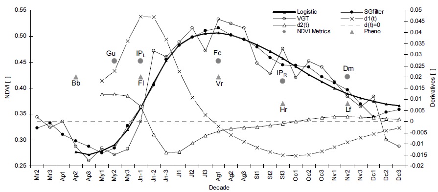
Six
smoothing methods can be used to fit the data:
Savitzky-Golay (SG), Piecewise Logistic (PL), Fourier Series (FS),
Gaussian
Model (GM), Polinomial Curve Fitting (PCF) and Cubic Smoothing Splines
(CSS). More information about these methods can be obtained in
the papers cited on the publications link.
The PhenoSat outputs are
two excel files with data and phenological information. In case of using the images as input, three phenological
maps (start of season,
maximum vegetation development and end of season) are also created.
The
software is a simple to use tool. For each step is
available an help document to provide an easy usage. The PhenoSat
application
was developed using the Matlab R2009a version and it is
advisable to use this or a later version, in order to avoid possible
funcionalities' errors.
PHENOSAT SOFTWARE